Spotting a Landing Site for Phoenix
Look Before You Leap
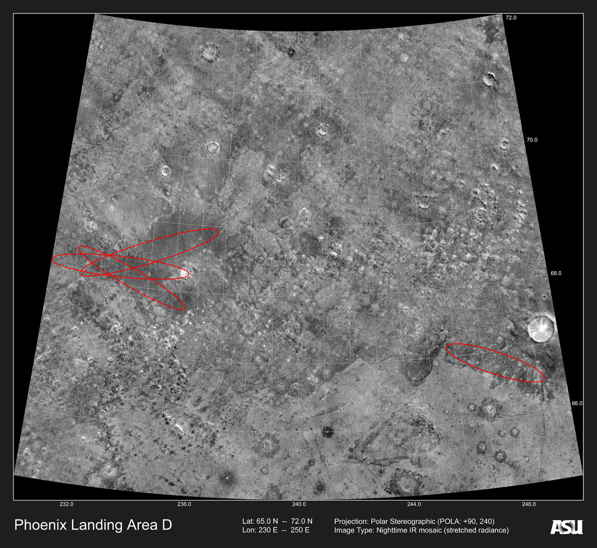
Red ovals mark Phoenix landing sites around 240 degrees east longitude and 68 degrees north latitude. The chosen site lay near the clustered ovals at left. The scene is a mosaic of THEMIS night infrared images, with lighter shades of gray indicating warmer and rockier ground. The smallest features visible in the original image are 100 meters (330 feet) wide.
NASA/JPL-Caltech/Arizona State University
Download OriginalScientists at Arizona State University's Mars Space Flight Facility used the Thermal Emission Imaging System on NASA's Mars Odyssey orbiter to help choose a safe landing site for the Phoenix Mars spacecraft. This mission, built under NASA's Mars Scout program, launched in August 2007 and landed in May 2008.
The goal of Phoenix was to set down at a high northern latitude, where water ice lies just under a thin, dry layer of soil. Phoenix, a non-roving lander, used its robot arm to scrape away the soil and collect a small sample of ice for analysis by its instruments.
THEMIS provided Phoenix project scientists with nighttime infrared images of candidate landing sites. The images pinpointed areas of warm ground which appeared strewn with large boulders that could have destroyed Phoenix on touchdown. By avoiding these warm areas, mission controllers were able to choose a landing site that was safe.
News
Friday, June 19
Tuesday, September 6
Thursday, March 5
Monday, August 6