
3 Ways to Explore Mars


Image of the Day

News
Friday, June 19
Tuesday, September 6
Thursday, March 5
Live from Mars
Develop the Next Generation of Explorers!
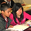 The ASU Mars Education Program provides formal and informal curriculum and resources for standards-aligned STEM education using the excitement of NASA and space exploration. We have Mars STEM resources for educators, administrators, and the public.
Take your students to Mars!